Thursday, August 7, 2014

Motorcycle camping and a ride to the top of Mt. Washington to see the sunrise.

Krystal and I wanted a vacation together so we thought we would do a long weekend motorcycle camping trip. The Mt. Washington auto road get opened up early 3 time a summer so you can watch the sunrise from the summit. We tried to do this last year and did not realize how popular it was and had to wait in line so much that we were halfway up when the sun came up. This time we would camp nearby and get there way early and not miss it.

Thursday after getting my Multistrada back I took a large pelican case and a DIY kit from cariboucases.com and affixed it to by Altrider.com luggage rack. (link to be added for install report).This would give me much better water tight and secure luggage.

Friday we went to work and after work loaded up and headed to New Hampshire


The ride out was good. Clear skies and good roads. There was a slight miscalculation on rout and the fact it was Friday in the summer, so we hit traffic in Westbrook, then Gorham and again in No. Conway. We had decided to  bring a full sized air mattress instead of the 2 self inflating camp mats because it took up less space even though it was heavier. But, the two ways to inflate it were missing power. one needed batteries the other had a car lighter adapter. I figured I would stop at Whitehorse Gear on the way up for an adapter but due to the traffic they were closed when we got there. So, I swung into the Conway Hanniford for batteries. Krystal did not realize what I was doing and exited early out of the traffic circle cause she had not set up for the longer corner. over the headset I hear "oops I missed the turn .... OMG a BEAR." as she came out of the circle a bear came out of the woods and looked at her another car went by and it crossed the street and took off into the woods. I guess it was confused by what she was. But, black bears being what they are and not wanting trouble it just took off. By time I got to her it was gone.
After that excitement we grabbed the batteries and headed up to our campsite. The Campground we chose was Barns Field  just about 4 miles south of Gorham NH. we did not realize it but it is a Group campground and more expensive than the Dolly Copp Campground but it was still very nice. We rolled in and found our site. Krystal went off to go check us in and I started the unload and setup. I was worried about it getting dark on us.


We were in Site 7 which is nicely wooded and separate for the other groups. I had the bikes unloaded and was laying out the tent (which i had never set up) when a golf cart rolled up with Krystal and 2 bundles of firewood. We chatted for a few about the other site and the fella with the golf cart headed off and we returned to setting up. Krystal took over with the Tent, it is her tent after all. and I set about organizing the stuff and getting the fire going.

The wood was a bit damp and I am a smige out of practice on camp fires but I did get it going I also set up the stove and made dinner. Our food planning was a bit lacking for the trip so for the first night we just did the Backpacking meals and figured we would hit a grocery store for the rest of the weekend. After eating we chilled for a little bit by the fire and then went to bed. The groups were not loud at all which I was a little worried about and sleeping was easy. I think Krystal got the first good night sleep in a week.
The next morning we got up made coffee. I have a GSI Drip coffee system it works well but for this kind of camping using paper filters would have made easier cleanup than the fabric one that comes with it. We heated up some precooked bacon and ate some oatmeal and set off to get some water and hiking food from the Cumbies in Gorham before our hike.
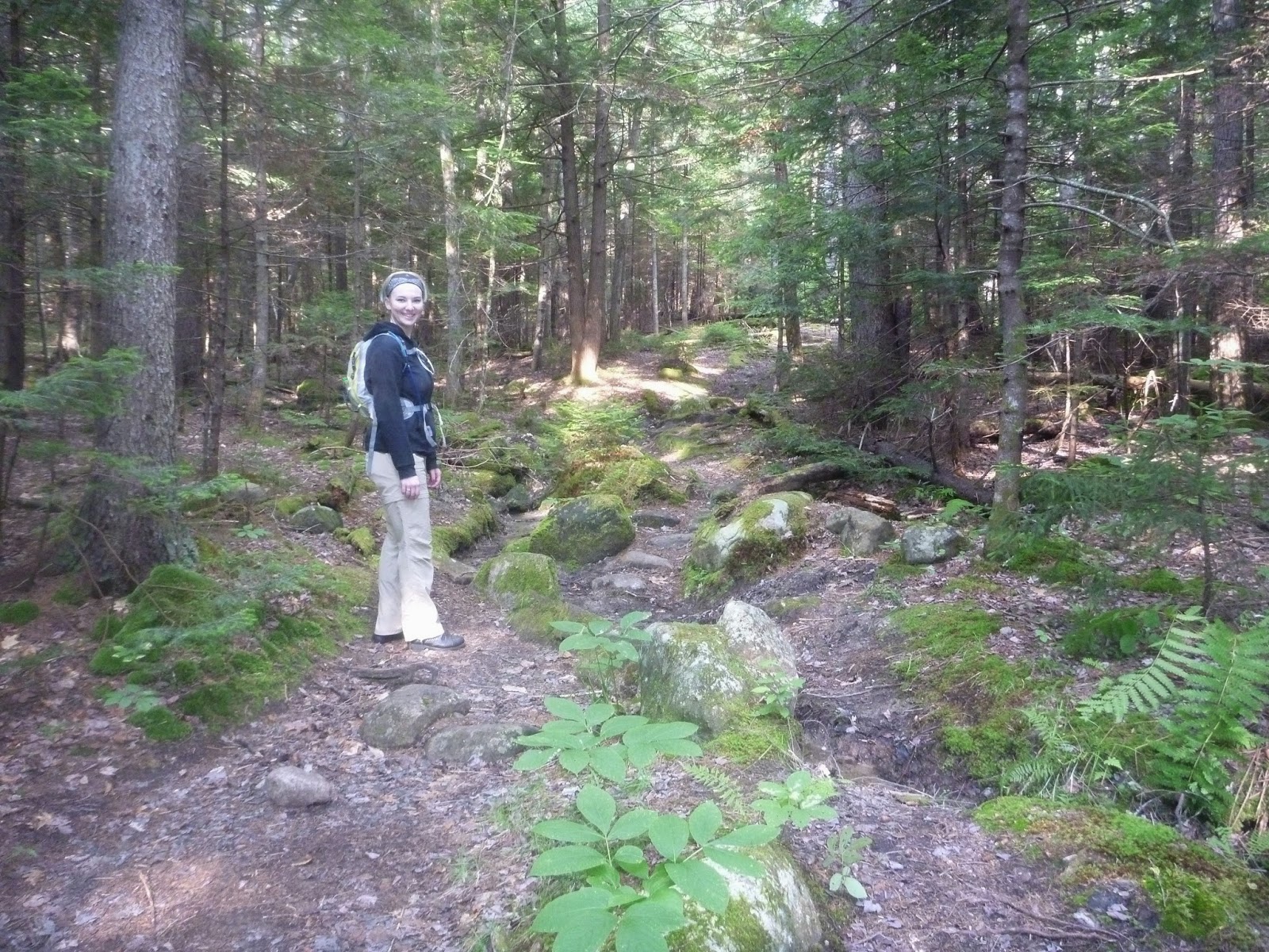
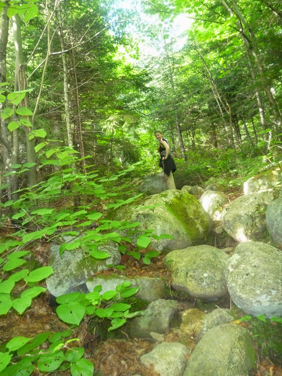

(Hike Report link )

We got back to the campsite after 11 hour on the trail and summiting a 5366' peak on a strenuous trail. Krystal was wreaked, she had not done much hiking recently and this one was a doozie. So, we got back to camp and hopped on the bikes ran out to top off the tanks so we would have enough gas for the sunrise ride grabbed a bundle of firewood, and she headed back to camp to chill and prep for dinner and sleep while I ran to the supermarket for the rest of supplies for dinner. Apparently the only supermarket in Gorham is a Walmart so I had to go there. We will plan food better next time. I got food and some more water and headed back to camp.
The fire proved to be a PIA again this night. all the wood was slightly damp and I was spending energy i did not have fanning it, then i remembered the battery mattress inflater. I just fired it up pointed it at the fire and left it while I got the camp stoves going and made dinner ( I wish I had a photo) in no time with no effort we had a roaring fire. Dinner was sausages and couscous and bread. We ate, cleaned up, packed up the bikes for tomorrow and went to bed. The alarm set for 2:30am so we could get to the Mt Washington auto road by 3:00.

2:30am


 The alarm goes off. ug still tired. We drag our asses out of the cosey sleeping bags into the dark all the stars in the universe are out over our heads. We did not want to wake up the entire campground so we coasted the bikes out of the campground. fortunately it is mostly downhill. When we get to the Auto road we are about 10ish cars from the front of the line, Perfect. it is about 3:00 they are going to open the road at 4:00 so I pull out the coffee making kit and start it brewing. the stars are clear as can be I tried to take but it did not come out. I really need a better low light camera. The coffee making photos worked though. We made our coffee and had packed up the fixings and were just starting to drink it when the gate opened and the line started to move we scrambled back to the bikes and had to dump the coffee cause they opened the road up 30 min early. So at 3:30-3:45ish we headed up Mt Washington
It was pitch black all you can see is the taillights of the vehicle in front of you. The road on one side just vanishes into darkness. We have our SMH10 bluetooth radios so the entire way up we have open com and can chat so Krystal can keep calm. this is her first time up the road on her own bike and she have not been riding long so she is a little stressed about it. It is kinda perfect, no one is coming down just us going up and you can't see the massive drop off. Up up up we go and just as we are reaching the summit we ride into a cloud. Thick fog engulfs the summit. Crap I hope this clears up before the sunrise or we are not going to see much. Krystal is super excited about having made it up.
we have at least an hour if not an hour and a half before the sunrise so we head into the observatory to get some more coffee and breakfast sandwiches. As we start up the stairs I can feel yesterdays hike in my tired legs but Krystal's are really hurting she is walking really stiff and sore. I totally over worked her. I need to get better at my trail research.  We get up to the observatory, Krystal hits the gift shop for a patch and then we get our food and sit down to wait.
After our food we made our way back outside into the fog, slowly. The statue of the hiker looks quite creepy in the fog. Actually on the way in it kinda startled me as my headlamp hit it. We waited and hoped for the fog to lift as the sky grew lighter and lighter, and then as if by magic the fog started to blow away.

and the light started to grow


and then the sun crested the horizon a red ball of fire.

it was very beautiful
As we had been waiting I moved the bikes down to a lower lot where we had a better view and so we could plug in the heated gear to try to warm up a little. it was quite chilly up there. But, chilly is really not a big deal it was so beautiful.

After the sunrise we walked back to the summit for a photo with the summit sign and to visit the newly renovated museum. The museum is quite nice. As we headed out it was starting to sprinkle a bit so we hurried up so we could get down before we got to much more. Fortunately it was still early and now that the sunrise traffic has abated so as we head down there is no traffic coming up which is perfect. As this is Krystal's first time riding her own bike on the mountain. I thought it was without incident but there was a smell starting from Krystal's bike I had not picked up on yet.
We stopped at the base for a victory photo.
 We then headed back into No. Conway and Conway for a bit of shopping. Stop one was Whitehorse Gear so we could check in say hi and and get a new taillight bulb for Igor. Whitehorse is a traditional stop for us when we are in the area. While there they told us of some weather coming in and we figured we should hurry up and get back to camp and batten down. We swing by Hanniford and get some food and firewood then a quick stop at Lowes for another tarp, and EMS for some more Para-cord and a pole to set up a canopy.
We then hitailed it back to camp and set up.

After we got back we set up a tarp and organized all the gear and prepared to wait out the rain. as we were finishing up the caretaker in the golf cart came by to tell us of the weather coming, and to make sure we were ok being the only ones in the Barns Field campground. everyone else had bugged out. He offered us a site at the Dolly Copp campground. We said we were ok. After he left we looked at the radar and the forecasts and it looked like not only would it rain soon but it would likely rain all night and into tomorrow. It looks like we are going to get wet and stay wet if we stay. So, it is time for us to bail. We do a rapid pack up and get done just as it starts to sprinkle. As we head north to loop up and around across 2 to 35 and back home before we got to Gorham and rt 2 it was raining. After fueling up we try to push ahead of the storm but are not able to. 
As we connect up to rt 302 Krystal complains about the smell from Igor. He smells like sulfur, my brain is tired and all I can think of is exhaust but that would not smell like that. We push through the traffic and get home, soaked to the bone. But, we are home and can dry out. 
We unpack and hang up all the gear and rest. the next day Krystal is getting ready to head off on Igor and he does not start and then I realize what is wrong and pop up the tank His battery is COOKED.

Turns out the regulator rectifier has freaked out and was pumping out over 18v into the battery. Fortunately we are home and not stranded in the woods or on a mountain.

So a chat with the guys at Moto Milano and a new Reg/Rec and I fix Igor by the next weekend and all is better. Thank go I bought the expensive battery with the Mats in it to hold the acid so it did not boil over and damage anything other than the battery itself.

And that is the first motorcycle camping trip.

Mt. Madison

We woke up at our campsite with no sense of urgency. Had a nice camp stove breakfast of oatmeal and precooked bacon with coffee and prepped to go hike. We took a quick run out to Gorham NH to grab some more water and bars for hiking food.
The plan was to grab a trail-head around the corner from the campsite. Hike up Mt Madison chill a bit at the top or at the hut then do Mt. Adams and then cut around Madison on the way back on the Pine Link trail. I had trouble finding it the trail-head as the road was closed and there was not bridge across the river. After looking at the map again we decided to take the Daniel Webster trail  out of the Dolly Copp campsite and then loop back to end up at our campsite at Barns Field.
8:00 am
Packs on we headed out. We start out heading down the camp road and into the Dolly Copp campground there was not one at the front gate yet so I could not double check to make sure the trail-head was really in here but this is about adventure right? So we head into the campsite. many people are stiring and getting read for the day some folks are going for their morning walk around the campsite. It is a really big campground with lots of options for types of camping, Whether it be camping in a field or in the woods.
As we get deeper and deeper into the campground I am still wondering if I will spot the trail head, so when a campground maintenance guy drives by in a golf cart I flag him down and ask. Yup we are on the right track we are almost there and we can't miss it. As I am speaking with the attendant Krystal talks with a couple who are going for a walk. They asked here what our rout was  she tells them we are going to hike Mt. Madison and they say that it is a tough hike. We are confident though (but maybe we are over-confident). Not far after that we came up on the trail-head  and were off.

The trail starts off a bit rocky and rooty but not to bad with the elevation change. The air is kinda still and sticky it does not take long for the trail to start going up.

We hit multiple areas with lots of rocks to hop from, the trail is pretty straight without switchbacks I shed the legs off my pants early on. Krystal followed suit a little after. The lack of breeze was making it feel so much hotter but we push on hoping to get moving air at higher elevations.

The rocks and roots turned to scrambles at times. I have a pair of Black Diamond trekking poles that I hike with, I have found it helps keep my legs from getting as tired. On this hike I passed one off to Krystal so she could try using it and see if it helped her as well. It did not take long for her to see the wisdom of them. So I guess she will need to get her own set soon.  We were keeping a good pace. I did not want to totally wear out Krystal so we did take some breaks.
Most of the wildlife we saw were your typical squirrels and birds. and some squirrel sign in the form of exploded pine-cones.
We started to get some breeze about the time we also started to get our first views.
There was a great deal of pondering as to what that body of water was out there i was unable to find it on the map. it was not until i was running out to the store that night that I found it is the reservoir  in Gorham NH well off my maps.
I started to really realize how tall this mountain was when we came to this sign
and I double checked the maps to see that we were going to be higher than Mt Katadin and within 1000 ft of Mt Washington.  Soon after the sign it became a scramble up a boulder field.


up up up we climb. Krystal has not done many hikes and the last big one she did was Mt. Chocorua which is 3,478 ft  and that was the summer before last. I really picked a doozie for the hike. But, she is doing great and feeling great despite the difficult terrain. We have all day to do this and if we only do Madison and not Adams it is ok and it is ok if we don't finish Madison we are out and doing it. which is fun.


The views are amazing and we take many breaks to enjoy them. We yo-yoed for a bit with another couple who were in their 60's though I would have said early 50's from the look of them. I was nice to get their take on the hike and the rout. He had a lot of experience in the area so it was cool to pick his brain. We crested the one false summit at the Osgood junction which is a junction with the Appellation Trail and realized we were looking right at Mt Washington.


It was really cool to see the autoroad from this perspective. The rest of the hike is a hard push up with lots of scrambles and I end up stowing my pole so I can use both hands to climb up the rocks.
 Krystal is really excited about the walk across the ridge the way the land just drops of on either side you can kind of see it in the picture. 


We reach the summit and for the first time in the entire hike we are fighting off bugs. The entire summit area as flying ants or something like that buzzing around getting in my mouth and such. It was frustratingly unpleasant I wanted to hang out at the summit for a little bit but was too pestered by the pests so we took our photos and headed down toward the Hut.


We headed off the summit and down the saddle between Madison and Adams. Looking up at Adams and at how tired Krystal is and how hard the hike has been so far we decide on not doing Adams as we head down I eves drop on, and then pick the brain of a couple other hikers as to which way down will be best. The way planned is not the best way but the other options take us way around. I figure we stick with the Pine Link Trail as planned it is most direct and according to my topo map has no more uphill.
For now, though, we descend toward the Madison Hut. I have never visited one of the Huts before and do not know what to expect. The white roof comes into view with the banks of big propane tanks. It is looking like a lot bigger place than I expected.  We pick our was down at a pretty good pace mostly because we both need to pee. Since people stay overnight there I am assuming there is some sort of restroom or outhouse.

When we get there I am quite pleasantly surprised it is really nice. there is an industrial kitchen where they are selling homemade backed goods and hot soup as well as a place to refill your water there is an indoor bathroom (latrine). Plus a little store for shirts and hats and stickers and some key items for hikers. We hung out for a little bit looked at maps had some food and refilled our water. After our rest we headed out.

On our way down to the hut we could see a bright white rock and a small lake on the saddle plateau area where the hut is. Before we started down we decided to check it out. It is really cool. A big chink of a marble vein sticking out of the ground. shining white in the sun, as you look around the area you can see other chunks of the white stone in the mountain side. The lake is small and shallow, but surrounded with wildflowers and a wonderful view. if we were staying the night I would love to just find a place to sit and chill here for a while.


After checking out the lake we headed to the Pine Link trail. I found the sign pointing its start. It wove off through the bushes and then through a small stream, getting Krystal's boots soaked then I lost it... so we went back and tried a slightly different entrance to the trail and it brought us to the same place I checked my map and compass and pushed through the bushes and spotted a cairn and then another. This is not a well traveled trail. It did not take long to see why. It did not go over the summit it went around it. Which it what I expected, but it was a traverse across a steep boulder field. It is quite exposed and though climbing up the other field was ok on this one Krystal could see the exposure with every step so the fear of heights started to kick in. She pushed on, pushing down the fear and going forward. It seemed to go on forever. But, we pushed through till it opened up again on the flatish alpine tundra
The stress of the traverse had taken a bunch of energy out of Krystal so I was glad it was a steady downhill to the campsite


But the downhill was not steady in fact as i look closer at the GPS topo map there is some ups and false summits on the trail, I had chosen to skip the Howker Ridge trail so as to avoid just that but it seems they are on this one as well. none of them were too serious but any up was taking effort. and the downs were pretty steep as well at times. We ran into a number of areas where streams ran the length of the trail making it slippery and footing a bit tough

Then the log walkways to go over the really wet spots and more scrambles in the woods over wet rocks to get down. Krystal's knees were really hurting so we took breaks when we could. But, we had to keep pushing on. I did not want it to get dark on us on the way down. Darkness would make it much harder to navigate this trail.

Krystal was being a real trooper. though she was not moving fast but she was going and now that the stressful part had passed her humor was back up though defiantly tiered. I was tired as well but still feeling good. The time at the gym has really helped I am glad I have been doing it I got a few knee tinges but not many and my wind is much better. This is giving me more drive to do more at the gym to get stronger so I can do more longer hikes.

There were a lot of places on this trail that required a bit of scrambling. I am sure it would be a lot more fun if we weren't so tired. The woods are also really beautiful and lush. There are cool bright blue berries, as well as red ones. old stone stairs.

our excitement abounds when we hear cars on the road and I spot the trail head sign. we still have a mile or so till the campground but it is on a mostly flat road and maybe we can hitch a ride down said road. But, unfortunately all the cars that go by are going the wrong direction. We make it back to the campsite exhausted and Krystal is quite sore.
We did around 11ish miles with an altitude gain of 4,469 ft to a max altitude of 5,366 and it took us about 12 hours. As you can see my phone went into battery saving mode and stopped tracking before the end of the hike so I have to estimate the rest. We were at 8.6 miles when it cut out.